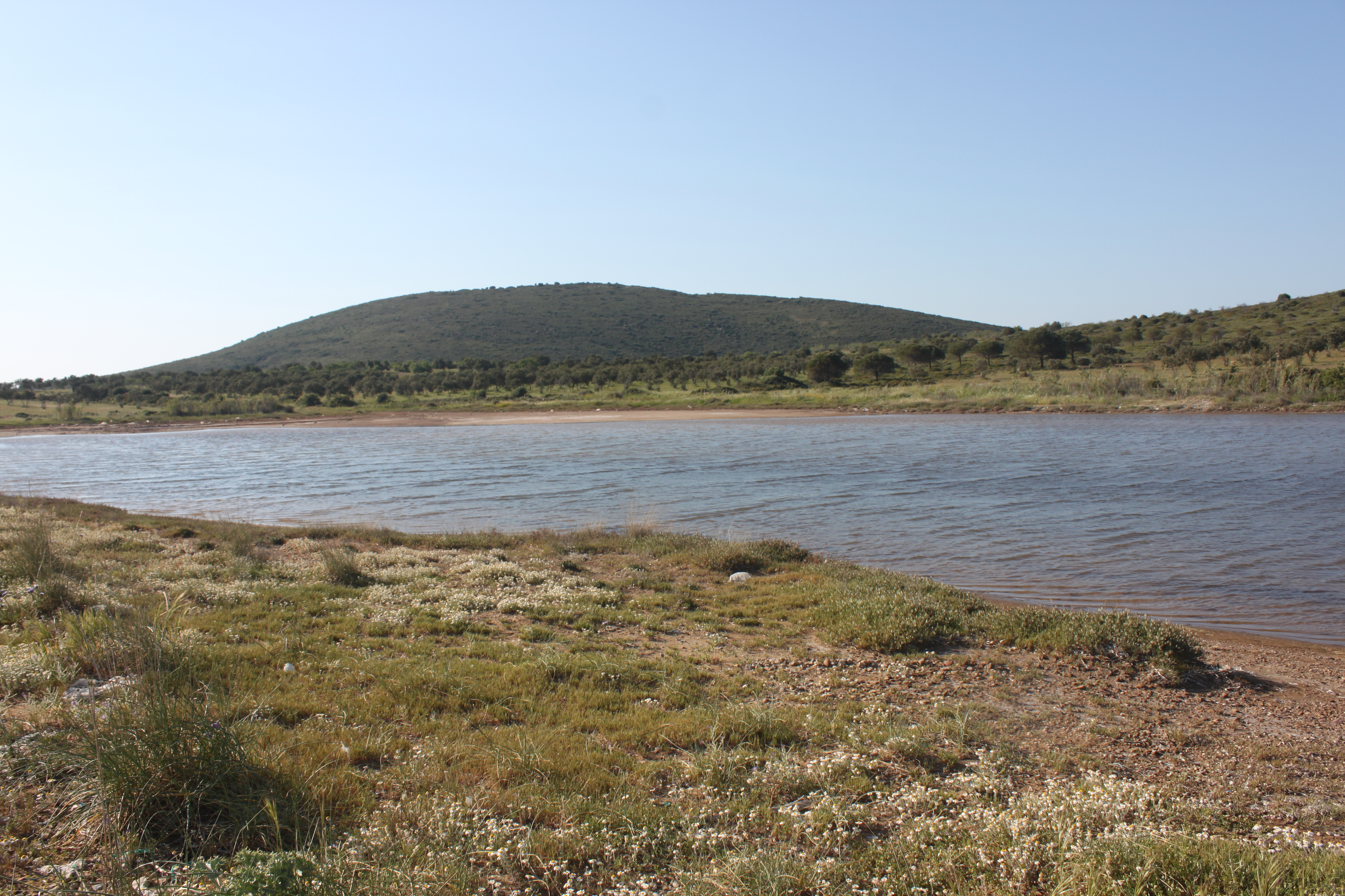
Located on the south-west coast of Patricia Peninsula, 7 km far from Cunda Island centre, Patricia Pond is a seasonal saltwater pond covering 1.40 ha. The road is in bad condition so the land access is usually possible by off-road vehicles. However, touristic sportive activities was observed during the field survey around the wetland. Olive farming is another human activity in the catchment area. The dunes around the pond is a nesting site for Charadrius alexandrinus. Recorded habitat types are Mediterranean salt meadows (Juncetalia maritimi) (1410), Mediterranean salt steppes (Limonietalia) (1510), Crucianellion maritimae fixed beach dunes (2210) and Salicornia and other annuals colonizing mud and sand (1310).
Wetland data
Basic information
Wetland location:
Marine/Coastal
Wetland type:
Natural
Wetland area:
1.4 Ha
Hydrological interaction:
-
Water salinity:
Salty (> 18.0 g/l)
Open water area (%):
26 - 50
Hydroperiod:
Permanent
Geographic information
Province:
Balikesir
Municipality:
Ayvalik
Island:
Alibey (Cunda)
Longitude:
26.603070 East
Latitude:
39.385821 North
Wetland condition
Wetland status (MEDWET):
3 - Original habitats/landform partially modified (10-50% untouched)
Ramsar wetland type
Type
Coverage (%)
Ts -- Seasonal/intermittent freshwater marshes/pools on inorganic soils; includes sloughs, potholes, seasonally flooded meadows, sedge marshes
51 - 75
E -- Sand, shingle or pebble shores; includes sand bars, spits and sandy islets; includes dune systems and humid dune slacks
5 - 25
Property status
Government - Municipal
Protection statuses
Protection status category
Protection status subcategory
Area's name
Coverage area (%)
Legislation
National
Nature Park
Ayvalik Islands Nature Park
100
National
Natural Protected Area
100
Ecosystem services
Type of ecosystem service
Ecosystem service
Scale of Βenefit (%)
Importance
Provisioning services
Food
Supporting services
Provision of habitat
Cultural services
Recreation and tourism
Activities on wetland
Activity
Intensity
620 = Outdoor sports and leisure activities
Medium
623 = motorised vehicles
Medium
700 = Pollution
Low
703 = soil pollution
Low
920 = Drying out
High
Activities on catchment area
Activity
Intensity
100 = Cultivation
Medium
162 = artificial planting
Medium
970 = Interspecific floral relations
Impacts
Impact
Intensity
AS- = Loss of scenic value
Medium
VC- = Change in vegetative species composition
Medium
VP- = Decrease in population of floral species
Low
Habitat types
Type
Coverage (%)
1410 Mediterranean salt meadows (Juncetalia maritimi)
5 - 25
1510 * Mediterranean salt steppes (Limonietalia)
2210 Crucianellion maritimae fixed beach dunes
5 - 25
1310 Salicornia and other annuals colonizing mud and sand
5 - 25
Vegetation types
Type
Coverage (%)
Halophytic
< 5
Ammophilous
< 5
Shrubby / Arborescent
5 - 25
Wet meadow
5 - 25
Flora
Species
Presence status
References
Anthemis tomentosa
Arundo donax
Atriplex portulacoides
Bromus sp.
Cakile maritima
Elymus farctus
Eryngium maritimum
Euphorbia paralias
Juncus maritimus
Limonium sinuatum
Limonium virgatum
Matthiola tricuspidata
Medicago marina
Parapholis incurva
Pistacia lentiscus
Salicornia sp
Salsola kali
Triglochin bulbosa
Fauna
Birds
Number of individuals
Nesting
References
Charadrius alexandrinus
1-10
Nesting
Larus michahellis
Anthus campestris
1-10
Emberiza calandra
1-10
Possible nesting
Galerida cristata
1-10
Possible nesting
Images
WWF Turkey. (2018). TrIsWet – Database of the Turkish island wetlands. Updated: 04.2024