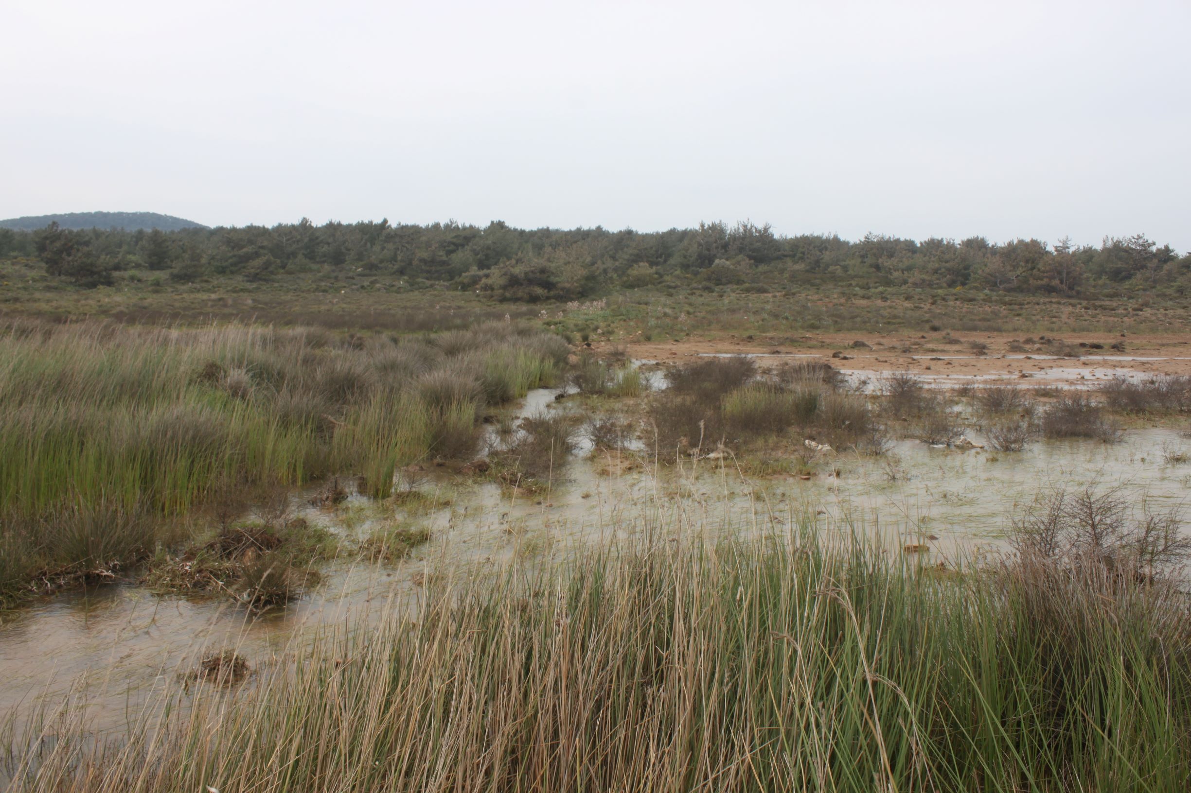
Located in the norteasth of Cunda Island, Zeytuna (East) Temporary Pond) is a marsh, fed by the underground water and salt water intrusion from the underground. After the road construction, the pond is fragmented and partly depressed, which resulted the precipitation to be another water source for the wetland. The water of the wetland is discharged to the sea with a small channel. The wetland area is 0,5 ha and the west part of the wetland is a wet meadow covered by Juncus sp. This constitutes the dominant vegetation (%76-95). 1410 Mediterranean salt meadows (Juncetalia maritimi) and 5420 Sarcopoterium spinosum phryganas are the main habitat types in the catchment area.
Wetland data
Basic information
Wetland location:
Marine/Coastal
Wetland type:
Natural
Wetland area:
0.5 Ha
Hydrological interaction:
-
Water salinity:
Brackish (5.0-18.0 g/l)
Open water area (%):
26 - 50
Hydroperiod:
Seasonal
Geographic information
Province:
Balikesir
Municipality:
Ayvalik
Island:
Alibey (Cunda)
Longitude:
26.632638 East
Latitude:
39.357343 North
Wetland condition
Wetland status (MEDWET):
3 - Original habitats/landform partially modified (10-50% untouched)
Ramsar wetland type
Type
Coverage (%)
H -- Intertidal marshes; includes salt marshes, salt meadows, saltings, raised salt marshes; includes tidal brackish and freshwater marshes
> 95
Property status
Government - Municipal
Protection statuses
Protection status category
Protection status subcategory
Area's name
Coverage area (%)
Legislation
National
Nature Park
Ayvalik Islands Nature Park
100
National
Natural Protected Area
100
Habitat types
Type
Coverage (%)
1410 Mediterranean salt meadows (Juncetalia maritimi)
51 - 75
5420 Sarcopoterium spinosum phryganas
< 5
Vegetation types
Type
Coverage (%)
Wet meadow
76 - 95
Shrubby / Arborescent
< 5
Flora
Species
Presence status
References
Asphodelus aestivus
Carex sp.
Juncus acutus
Juncus maritimus
Juncus subulatus
Sarcopoterium spinosum
Tamarix sp.
Images
WWF Turkey. (2018). TrIsWet – Database of the Turkish island wetlands. Updated: 04.2024