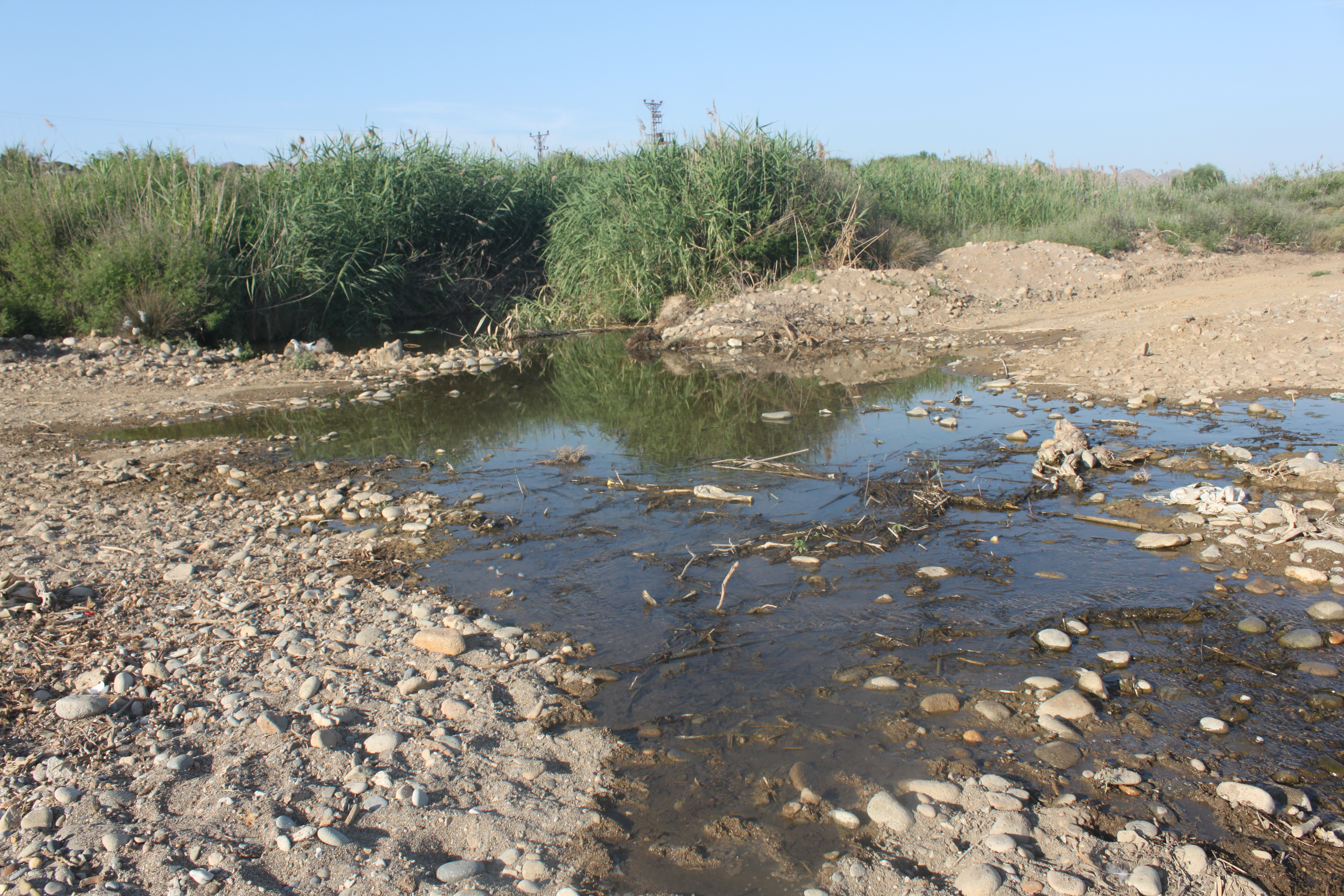
TR222GOK003 - Ugurlu Stream 1 (West)
Wetland data
Basic information
| Wetland location: |
Marine/Coastal |
| Wetland type: |
Natural |
| Wetland area: |
4.7 Ha |
| Hydrological interaction: |
Yes |
| Water salinity: |
Brackish (5.0-18.0 g/l) |
| Open water area (%): |
5 - 25 |
| Hydroperiod: |
Permanent |
Geographic information
| Province: |
Canakkale |
| Municipality: |
Gokceada |
| Island: |
Gokceada |
| Longitude: |
25.708831 East |
| Latitude: |
40.115005 North |
Wetland condition
| Wetland status (MEDWET): |
4 - Original habitats/landform highly modified (<10% untouched) |
Ramsar wetland type
| Type |
Coverage (%) |
| F -- Estuarine waters; permanent water of estuaries and estuarine systems of deltas |
> 95 |
Property status
| Government - Municipal / Private |
Protection statuses
| Protection status category |
Protection status subcategory |
Area's name |
Coverage area (%) |
Legislation |
| National |
Natural Protected Area |
|
40 |
|
Ecosystem services
| Type of ecosystem service |
Ecosystem service |
Scale of Βenefit (%) |
Importance |
| Provisioning services |
Fresh water |
|
|
| Supporting services |
Provision of habitat |
|
|
Activities on wetland
| Activity |
Intensity |
| 180 = Burning |
High |
| 421 = disposal of household waste |
High |
| 422 = disposal of industrial waste |
High |
| 440 = Storage of materials |
Medium |
| 701 = water pollution |
High |
| 703 = soil pollution |
High |
| 860 = Dumping depositing of dredged deposits |
High |
Activities on catchment area
| Activity |
Intensity |
| 170 = Animal breeding |
Medium |
| 703 = soil pollution |
Medium |
Impacts
| Impact |
Intensity |
| AS- = Loss of scenic value |
High |
| HF- = Habitat fragmentation |
High |
| HL- = Habitat loss |
High |
| LI- = Decrease in other socio-economic value(s) |
Medium |
| LS- = Decrease in water supply |
High |
| LW- = Decrease in wilderness/wildlife values |
High |
| PS- = Sewage pollution |
High |
| VCD = Loss of floral diversity |
High |
| VS- = Change in vegetative structure |
High |
Habitat types
| Type |
Coverage (%) |
| 1410 Mediterranean salt meadows (Juncetalia maritimi) |
5 - 25 |
| 1130 Estuaries |
51 - 75 |
| 92D0 Southern riparian galleries and thickets (Nerio-Tamaricetea and Securinegion tinctoriae) |
5 - 25 |
| 72A0 Reed thickets |
51 - 75 |
Vegetation types
| Type |
Coverage (%) |
| Emergent |
76 - 95 |
| Wet meadow |
5 - 25 |
| Shrubby / Arborescent |
5 - 25 |
Flora
| Species |
Presence status |
References |
| Imperata cylindrica |
Co-dominant |
|
| Juncus maritimus |
Present |
|
| Limonium sp. |
Present |
|
| Nerium oleander |
Present |
|
| Phragmites australis |
Dominant |
|
| Vitex agnus-castus |
Co-dominant |
|
Fauna
Birds |
Number of individuals |
Nesting |
References |
| Alauda arvensis |
|
|
|
| Carduelis carduelis |
1-10 |
Possible nesting |
|
| Emberiza melanocephala |
1-10 |
Possible nesting |
|
| Hirundo rustica |
|
Not nesting |
|
| Passer domesticus |
10-100 |
Nesting |
|