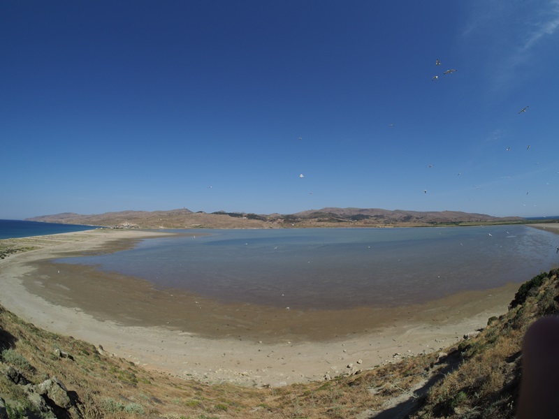
TR222GOK009 - Gokceada Lagoon
Wetland data
Basic information
| Wetland location: |
Marine/Coastal |
| Wetland type: |
Natural |
| Wetland area: |
430.0 Ha |
| Hydrological interaction: |
- |
| Water salinity: |
Salty (> 18.0 g/l) |
| Open water area (%): |
51 - 75 |
| Hydroperiod: |
Permanent |
Geographic information
| Province: |
Canakkale |
| Municipality: |
Gokceada |
| Island: |
Gokceada |
| Longitude: |
25.955524 East |
| Latitude: |
40.133600 North |
Wetland condition
| Wetland status (MEDWET): |
2 - Original habitats/landform still predominant (>50%) |
Ramsar wetland type
| Type |
Coverage (%) |
| J -- Coastal brackish/saline lagoons; brackish to saline lagoons with at least one relatively narrow connection to the sea |
76 - 95 |
| K -- Coastal freshwater lagoons; includes freshwater delta lagoons |
5 - 25 |
| E -- Sand, shingle or pebble shores; includes sand bars, spits and sandy islets; includes dune systems and humid dune slacks |
5 - 25 |
Property status
| Government - Municipal / Private |
Protection statuses
| Protection status category |
Protection status subcategory |
Area's name |
Coverage area (%) |
Legislation |
| National |
Natural Protected Area |
|
100 |
|
| National |
Wetlands of National Importance |
Gokceada Lagoon |
100 |
|
Ecosystem services
| Type of ecosystem service |
Ecosystem service |
Scale of Βenefit (%) |
Importance |
| Cultural services |
Cultural heritage |
|
|
| Regulatory services |
Erosion regulation |
|
|
| Provisioning services |
Food |
|
|
| Supporting services |
Provision of habitat |
|
|
| Cultural services |
Recreation and tourism |
|
|
| Regulatory services |
Storm hazard regulation |
|
|
Activities on wetland
| Activity |
Intensity |
| 140 = Grazing |
Medium |
| 170 = Animal breeding |
Medium |
| 230 = Hunting |
Unknown |
| 409 = other patterns of habitation |
Low |
| 511 = electricity lines |
Low |
| 608 = camping and caravans |
Medium |
| 629 = other outdoor sports and leisure activities |
High |
| 701 = water pollution |
Unknown |
| 703 = soil pollution |
Unknown |
| 830 = Canalisation |
Medium |
| 853 = management of water levels |
Medium |
| 920 = Drying out |
Medium |
Activities on catchment area
| Activity |
Intensity |
|
|
| 130 = Irrigation |
Unknown |
| 140 = Grazing |
Medium |
| 170 = Animal breeding |
Unknown |
| 409 = other patterns of habitation |
Low |
| 421 = disposal of household waste |
Unknown |
| 501 = paths tracks cycling tracks |
Medium |
| 511 = electricity lines |
Low |
| 608 = camping and caravans |
Medium |
| 621 = nautical sports |
High |
| 701 = water pollution |
Unknown |
| 830 = Canalisation |
Unknown |
Impacts
| Impact |
Intensity |
| FB- = Disruption of natural balance/interaction between faunal species |
Medium |
| PF- = Fertilizer/Excess nutrient pollution |
Medium |
| PS- = Sewage pollution |
Unknown |
| VC- = Change in vegetative species composition |
Low |
Habitat types
| Type |
Coverage (%) |
| 1150 * Coastal lagoons |
51 - 75 |
| 1410 Mediterranean salt meadows (Juncetalia maritimi) |
5 - 25 |
| 5420 Sarcopoterium spinosum phryganas |
< 5 |
| 5340 Garrigues of Eastern Mediterranean |
< 5 |
| 2120 Shifting dunes along the shoreline with Ammophila arenaria (‘white dunes’) |
5 - 25 |
Vegetation types
| Type |
Coverage (%) |
| Wet meadow |
5 - 25 |
| Ammophilous |
26 - 50 |
| Shrubby / Arborescent |
< 5 |
Flora
| Species |
Presence status |
References |
| Aeluropus littoralis |
Present |
|
| Ammophila arenaria |
Dominant |
|
| Centaurea spinosa |
Present |
|
| Cyperus sp. |
Present |
|
| Eryngium maritimum |
Present |
|
| Euphorbia paralias |
Present |
|
| Euphorbia peplis |
Present |
|
| Imperata cylindrica |
Co-dominant |
|
| Limonium gmelini |
Present |
|
| Nerium oleander |
Present |
|
| Parapholis incurva |
Present |
|
| Phragmites communis |
Present |
|
| Quercus sp. |
Co-dominant |
|
| Saccharun ravenae |
Present |
|
| Salsola kali |
Present |
|
| Scirpoides holoschoenus |
Dominant |
|
| Spergularia salina |
Present |
|
| Sporobolus virginicus |
Present |
|
| Verbascum sinuatum |
Present |
|
Fauna
Invertebrates |
Presence status in wetland |
References |
|
| Melanargia larissa |
Present |
|
|