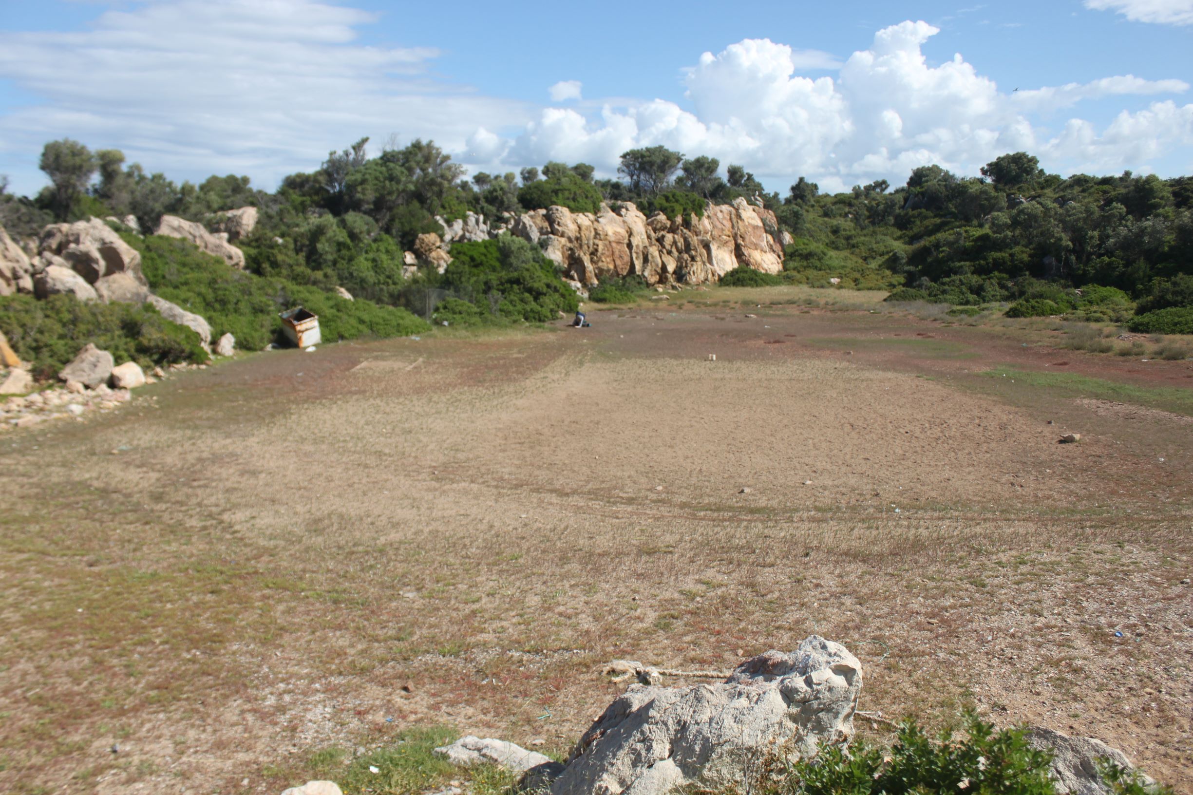
TR310ILD001 - Kose Island Sand Flat
Wetland data
Basic information
| Wetland location: |
Marine/Coastal |
| Wetland type: |
Natural |
| Wetland area: |
0.2 Ha |
| Hydrological interaction: |
- |
| Water salinity: |
Salty (> 18.0 g/l) |
| Open water area (%): |
< 5 |
| Hydroperiod: |
Seasonal |
Geographic information
| Province: |
Izmir |
| Municipality: |
Ildir |
| Island: |
Yassiada |
| Longitude: |
26.464305 East |
| Latitude: |
38.375446 North |
Wetland condition
| Wetland status (MEDWET): |
2 - Original habitats/landform still predominant (>50%) |
Ramsar wetland type
| Type |
Coverage (%) |
| G -- Intertidal mud, sand or salt flats |
> 95 |
Property status
Protection statuses
| Protection status category |
Protection status subcategory |
Area's name |
Coverage area (%) |
Legislation |
| National |
Natural Protected Area |
|
100 |
|
Habitat types
| Type |
Coverage (%) |
| 1310 Salicornia and other annuals colonizing mud and sand |
51 - 75 |
| 1410 Mediterranean salt meadows (Juncetalia maritimi) |
< 5 |
| 3140 Hard oligo-mesotrophic waters with benthic vegetation of Chara spp. |
< 5 |
Vegetation types
| Type |
Coverage (%) |
| Halophytic |
51 - 75 |
| Submerged |
< 5 |
| Shrubby / Arborescent |
< 5 |
| Wet meadow |
< 5 |
| Other |
5 - 25 |
Flora
| Species |
Presence status |
References |
| Atriplex portulacoides |
|
|
| Carex sp. |
|
|
| Chara sp. |
|
|
| Juncus sp. |
|
|
| Limonium gmelini |
|
|
| Limonium virgatum |
|
|
| Pistacia lentiscus |
|
|
| Plantago lagopus |
|
|
| Plantago maritima |
|
|
| Polypogon monspeliensis |
|
|
| Salicornia sp. |
Dominant |
|
| Sarcopoterium spinosum |
|
|
| Spergularia marina |
|
|