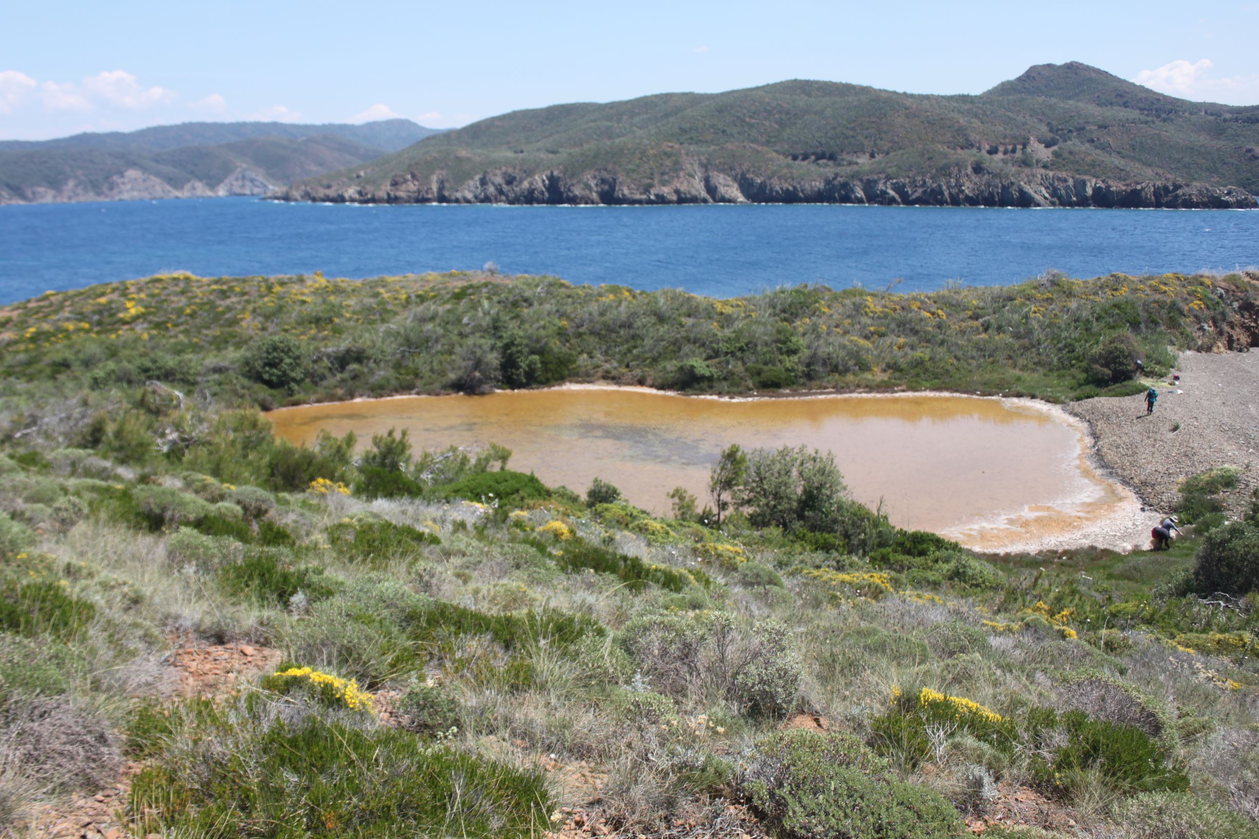
TR323MRM001 - Golluada Pond
Wetland data
Basic information
| Wetland location: |
Marine/Coastal |
| Wetland type: |
Natural |
| Wetland area: |
0.2 Ha |
| Hydrological interaction: |
- |
| Water salinity: |
Salty (> 18.0 g/l) |
| Open water area (%): |
> 95 |
| Hydroperiod: |
Permanent |
Geographic information
| Province: |
Mugla |
| Municipality: |
Marmaris |
| Island: |
Golluada |
| Longitude: |
28.035212 East |
| Latitude: |
36.883997 North |
Wetland condition
| Wetland status (MEDWET): |
1 - Untouched. No signs of man-made changes |
Ramsar wetland type
| Type |
Coverage (%) |
| Zk(a) -- Karst and other subterranean hydrological systems, marine/coastal |
> 95 |
| E -- Sand, shingle or pebble shores; includes sand bars, spits and sandy islets; includes dune systems and humid dune slacks |
< 5 |
Property status
Protection statuses
| Protection status category |
Protection status subcategory |
Area's name |
Coverage area (%) |
Legislation |
| National |
Natural Protected Area |
|
100 |
|
| International |
Special Environmental Protection Area |
Gokova Special Environmental Protection Area |
100 |
|
Habitat types
| Type |
Coverage (%) |
| 1310 Salicornia and other annuals colonizing mud and sand |
< 5 |
| 1510 * Mediterranean salt steppes (Limonietalia) |
< 5 |
Vegetation types
| Type |
Coverage (%) |
| Halophytic |
5 - 25 |
| Submerged |
51 - 75 |
| Shrubby / Arborescent |
< 5 |
| Ammophilous |
< 5 |
Flora
| Species |
Presence status |
References |
| Arundo donax |
Present |
|
| Atriplex portulacoides |
Present |
|
| Centaurium erythraea |
Present |
|
| Inula chritmoides |
Present |
|
| Limonium gmelini |
Present |
|
| Oenanthe apuatica |
|
|
| Pancratium maritimum |
Present |
|
| Pistacia lentiscus |
Present |
|
| Ruppia maritima |
Present |
|
| Salicornia sp. |
Present |
|