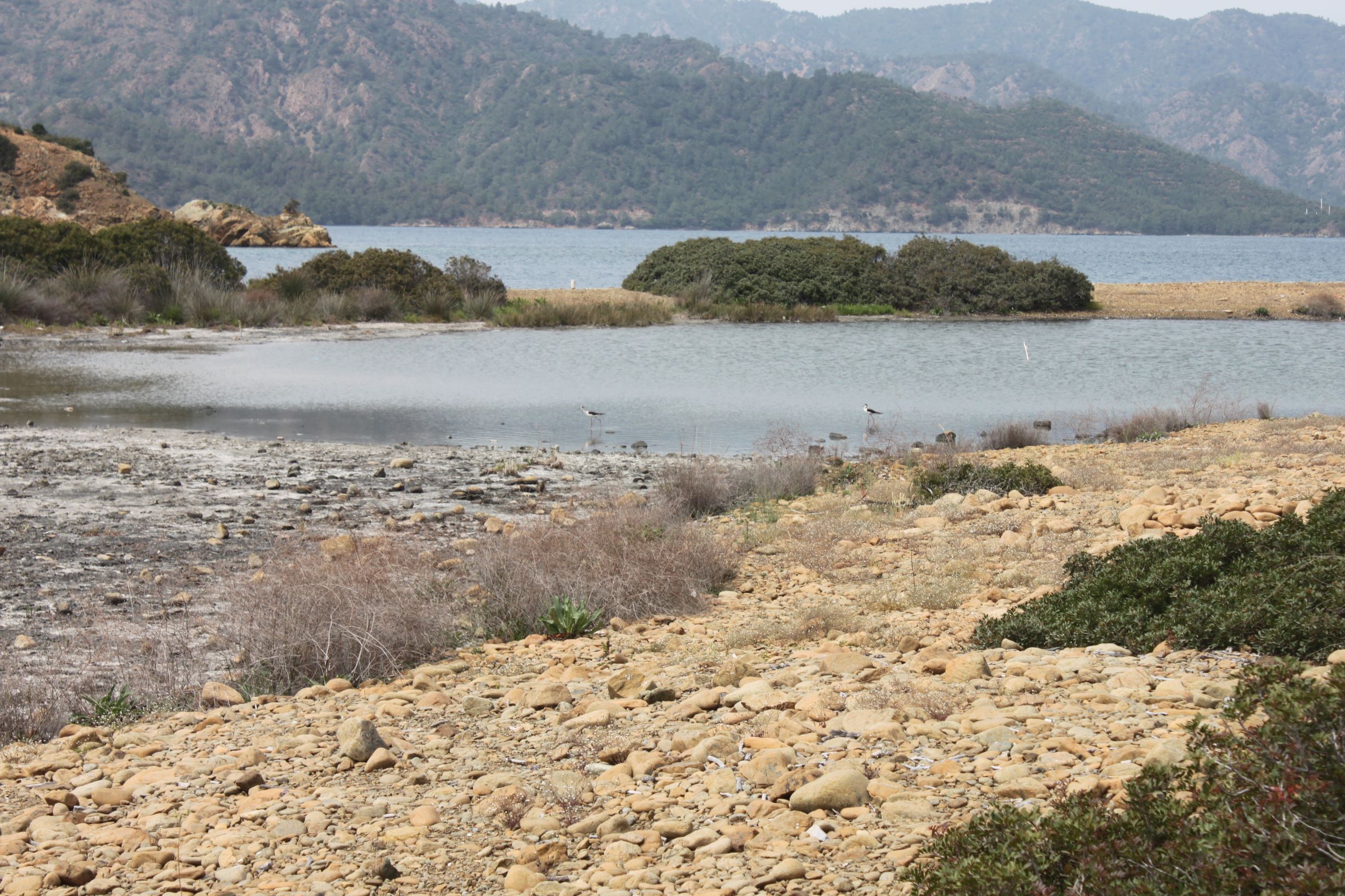
TR323GOC002 - Yassica Islands Pond
Wetland data
Basic information
| Wetland location: |
Marine/Coastal |
| Wetland type: |
Natural |
| Wetland area: |
0.4 Ha |
| Hydrological interaction: |
- |
| Water salinity: |
Fresh (< 0.5 g/l) |
| Open water area (%): |
> 95 |
| Hydroperiod: |
Permanent |
Geographic information
| Province: |
Mugla |
| Municipality: |
Dalaman |
| Island: |
Yassica (West) |
| Longitude: |
28.930993 East |
| Latitude: |
36.710097 North |
Wetland condition
| Wetland status (MEDWET): |
1 - Untouched. No signs of man-made changes |
Ramsar wetland type
| Type |
Coverage (%) |
| Zk(a) -- Karst and other subterranean hydrological systems, marine/coastal |
> 95 |
Property status
Protection statuses
| Protection status category |
Protection status subcategory |
Area's name |
Coverage area (%) |
Legislation |
| National |
Natural Protected Area |
|
100 |
|
Ecosystem services
| Type of ecosystem service |
Ecosystem service |
Scale of Βenefit (%) |
Importance |
| Supporting services |
Provision of habitat |
|
|
Activities on wetland
| Activity |
Intensity |
| 690 = Other leisure and tourism impacts not referred to above |
Unknown |
| 700 = Pollution |
Unknown |
| 701 = water pollution |
Low |
| 703 = soil pollution |
Low |
| 951 = drying out / accumulation of organic material |
Unknown |
Activities on catchment area
| Activity |
Intensity |
| 690 = Other leisure and tourism impacts not referred to above |
Unknown |
| 700 = Pollution |
Low |
| 701 = water pollution |
Low |
| 703 = soil pollution |
Low |
| 790 = Other pollution or human impacts/activities |
|
| 970 = Interspecific floral relations |
Unknown |
Habitat types
| Type |
Coverage (%) |
| 5340 Garrigues of Eastern Mediterranean |
5 - 25 |
Vegetation types
| Type |
Coverage (%) |
| Shrubby / Arborescent |
5 - 25 |
| Emergent |
< 5 |
Flora
| Species |
Presence status |
References |
| Cakile maritima |
|
|
| Cistus salvifolius |
|
|
| Erica manipuliflora |
|
|
| Phragmites communis |
|
|
| Pinus brutia |
|
|
Fauna
Birds |
Number of individuals |
Nesting |
References |
| Accipiter nisus |
1-10 |
Possible nesting |
|
| Charadrius dubius |
1-10 |
Unknown |
|
| Carduelis cannabina |
10-100 |
|
|